When it comes to data collection and management, few come close to NASA’s repertoire. Between space, atmospheric, oceanic, and various other Earth sciences, NASA has collected a staggering amount of data. It can be difficult and tedious to extract and analyze specific datasets from it. The following are three technologies that put NASA’s vast data sets to use through various accessible and user-centered applications.
Virtual Assistant Meets Earth Science Data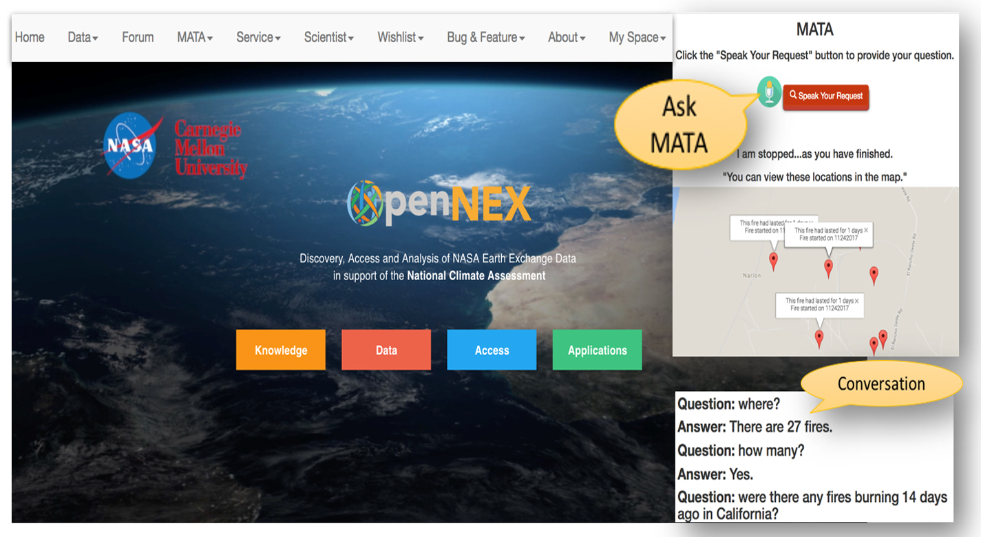
Imagine being able to ask a digital assistant like Alexa or Siri a geospatial question. NASA Ames has developed with MATA – an intelligent conversational research assistant for the Earth science community. Using 40 years and hundreds of terabytes of NASA earth science data, MATA provides conversational computing and answers that are geospatially and spatio-temporally aware. This technology uses open-source software and continuously integrates community intelligence. It also allows users to add new capabilities and APIs. MATA can see applications in data management, geospatial data, disaster management, geospatial analytics, and weather data and forecasting (WD&F).
Highly Reconfigurable, High Fidelity, Yet Low-Cost Flight Simulator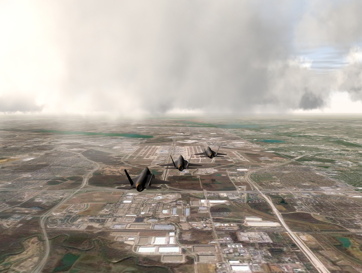
This invention was developed as part of the U.S. Air Force-sponsored Operational Based Vision Assessment (OBVA) program. The program was tasked with developing a high-fidelity flight simulation laboratory, creating the capability to examine the relationship between pilot visual capabilities and performance in simulated tasks. The exceptional visual acuities of the Air Force pilot population required the simulator to present significantly greater pixel density than was currently available in existing technologies. This necessitated the development of a higher-fidelity image generator system than systems currently available as a complete solution. This innovation resulted in a 150 mega-pixel synchronized, continuous display system driving real-time computer-generated imagery at a 60-Hz refresh rate.
The system, the Reconfigurable Image Generator (RIG), consists of software and a hardware configuration, and a Synthetic Environment Database Generation System (RIG-DBGS). Through a combination of commerical-off-the-shelf tools and in-house created applications, the semi-automated system can process large amounts of data in days rather than weeks or months, a disadvantage of manual database generation.
Scalable, Decentralized, Open-Access Space Traffic Management (STM) Architecture
As the number of satellites in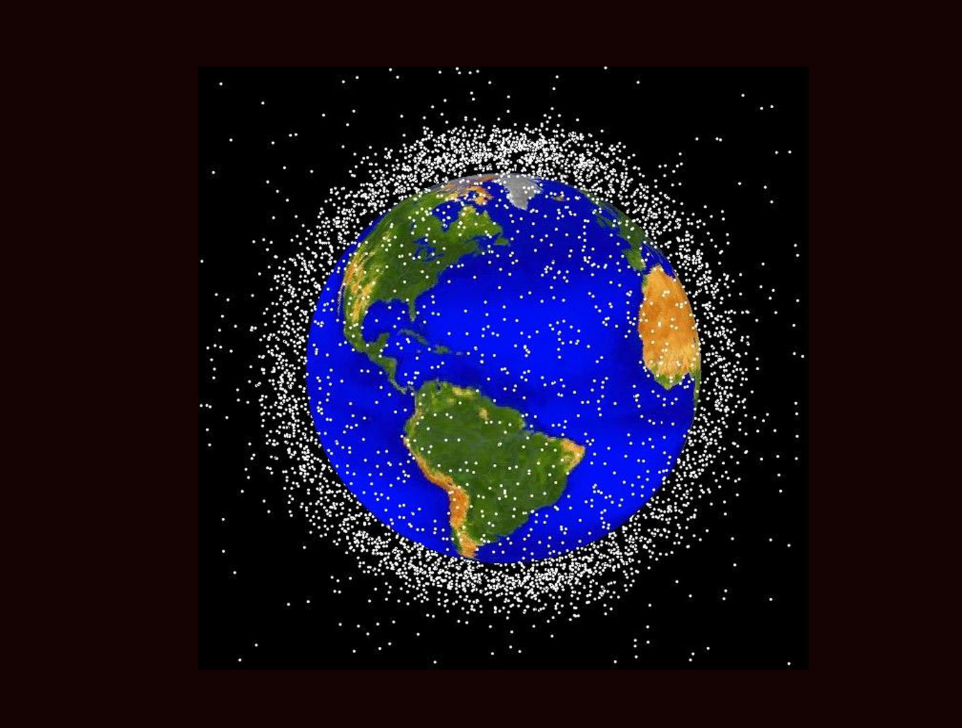 orbit has increased, so has congestion in space. Though that trend shows no signs of slowing, NASA Ames has developed a novel patent-pending technology that will help to protect commercial and other space assets. Space Traffic Management (STM) Architecture provides a framework for on-orbit coordination of activities to ensure that the orbital population avoids collisions and radio-frequency interference. By providing standardized roles, an open-access architecture, and application programming interfaces (APIs), the STM Architecture reduces the STM burden for small owners/operators. The technology also enables any interested entity to join the system and enables automation between participants to make the system scalable and sustainable. The STM Architecture has applications as an STM Service Supplier (S3), a Space Situational Awareness Supplier (SSA), a Conjunction Assessment Supplier (CAS), Supplemental Data Supplier, and in universities and research institutions.
Are you interested in licensing the technology mentioned above? Follow the links to apply through our website. You can also browse our entire technology portfolio here.
Follow the NASA Technology Transfer Program on Twitter @NASAsolutions for the latest updates on technologies available for licensing.

