More Reliable Doppler Lidar for Autonomous Navigation
sensors
More Reliable Doppler Lidar for Autonomous Navigation (LAR-TOPS-351)
Sensor algorithm salvages compromised lidar signal data
Overview
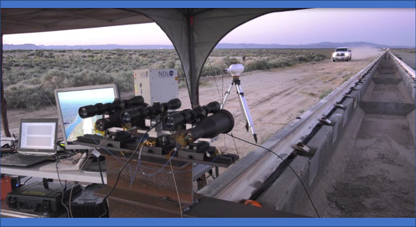
NASA pioneered Navigation Doppler Lidar (NDL) for precision navigation and executing well-controlled landings on surfaces like the moon. The lidar sensor utilizes Frequency Modulated Continuous Wave (FMCW) technique to determine the distance to the target and the velocity between the sensor and target. Specifically, homodone sensors obtain the changes in signal frequency between the received and reference frequencies for calculating both speed and distance. However, homodyne detection cannot provide any phase information. This is a problem because the current sensor cannot determine the sign (+/-) of the signal frequencies, resulting in false measurements of range and velocity. NASA has developed an operational prototype (TRL 6) of the method and algorithm that works with the receiver to correct the problem. Using a three-section waveform and an algorithm to resolve ambiguities in sign when the signal is compromised, the algorithm analyzes historical phase information to interpret the sign of the remaining frequencies and recover the phase information that contains valuable measurement information.
The Technology
The NDL uses homodyne detection to obtain changes in signal frequency caused by a target of interest. Frequency associated with each segment of the modulated waveform collected by the instrument is positive or negative, depending on the relative range and direction of motion between the NDL and the target. Homodyne detection offers a direct measurement of signal frequency changes however only the absolute values of the frequencies are measured, therefore additional information is necessary to determine positive or negative sign of the detected frequencies. The three segmented waveform, as opposed to conventional two-segmented ones, allows for resolving the frequency sign ambiguity. In a practical system, there are times when one or more of the three frequencies are not available during a measurement. For these cases, knowledge of the relative positions of the frequency sideband components is used to predict direction of the Doppler shift and sign, and thus make correct range and velocity measurements. This algorithm provides estimates to the sign of the intermediate frequencies. The instrument operates continuously in real time, producing independent range and velocity measurements by each line of sight used to take the measurement. In case of loss of one of the three frequencies, past measurements of range and velocity are used by the algorithm to provide estimates of the expected new range and velocity measurement. These estimates are obtained by applying an estimation filter to past measurements. These estimates are used during signal loss to reduce uncertainty in the sign of the frequencies measured once signals are re-established, and never to replace value of a measurement.


Benefits
- Increased reliability of lidar data: reduces ambiguities that are due to partial loss of a signal
- Easy implementation: algorithm works with current homodone sensors
- Optimal data use: recovers valuable information from partial data signals
- Improves safety and efficiency: reduces the chance of errors due to misread signals.
Applications
- Self-driving cars: provides both 3D range and Doppler (velocity) images of surroundings
- Aircraft Navigation: system allows navigation in GPS-denied environments
- General Automated Rendezvous and Docking: provides relative position, approach velocity, and relative orientation and attitude of the docking port.
- Space: NDL can enable precision navigation to the desired landing location for future large robotic and crewed landing missions,.
Technology Details
sensors
LAR-TOPS-351
LAR-19687-1
Amzajerdian, Pierrottet, et. al. Navigation Doppler Lidar Performance at High Speed and Long Range. 2020 AIAA SciTech Forum. April 2020.
Farzin Amzajerdian, Glenn D. Hines, et al. Characterization of a Coherent Doppler Lidar for Operation Onboard Aerial and Space Vehicles. OSA Laser Congress September 29 - October 3, 2019.
Farzin Amzajerdian, Glenn D. Hines, et al. Characterization of a Coherent Doppler Lidar for Operation Onboard Aerial and Space Vehicles. OSA Laser Congress September 29 - October 3, 2019.
|
Tags:
|
|
|
Related Links:
|
Similar Results

Reconfigurable Local Oscillator for Coherent Optical Detection
The innovation expands the range of signals that coherent optical receivers can detect. Unlike traditional systems with fixed LOs, this approach allows real-time adjustments to an LO’s properties, such as frequency, phase, polarization, amplitude, spatial mode, or timing, to better match incoming signals. These adjustments improve measurement accuracy and signal recovery in various scenarios, such as shifting heterodyne frequencies into the receiver’s bandwidth or adapting to different signal polarizations. The innovation lies in the ability to switch an LO's configurations on the fly using technologies like fiber-optic or integrated photonic switches, as well as other methods like optical modulation or tunable delay lines. This dynamic capability allows coherent receivers to switch seamlessly between range-Doppler and Doppler-only modes. As a result, a single system can track both nearby, slow-moving targets and distant, high-velocity objects (up to 20+ km/s) while operating with a compact, low-speed receiver (

Laser Linear Frequency Modulation System
For decades, frequency modulation has been used to generate chirps, the signals produced and interpreted by sonar and radar systems. Traditionally, a radio or microwave signal is transmitted toward the target and reflected back to a detector, which records the time elapsed and calculates the targets distance. Reflected signals can be heterodyned (combined) with output signals to determine the Doppler frequency shift and the target velocity. Accuracy of these systems can be enhanced by increasing the bandwidth of the chirp, but noise generated during heterodyning at high frequencies decreases the signal-to-noise ratio, increasing measurement error.
Previous attempts at laser frequency modulation that relied on adjusting the laser cavity length have resulted in only sine wave or imperfect triangle waveforms. Heterodyning of imperfect, non-linear waveforms or sine waveforms will significantly degrade the effective signal-to-noise ratio, making such systems impractical. In contrast, the current technology produces a single, high-frequency laser that is passed to an electro-optical modulator, which generates a series of harmonics. This range of frequencies is then passed through a band-pass optical filter so the desired harmonic frequency can be
isolated and directed toward the target. By modulating the electrical signal applied to the electro-optical modulator, a near perfect triangular waveform laser beam can be produced. Transmission and detection of this highly linear triangular waveform facilitates optical heterodyning for the calculation of precise frequency and phase shifts between the output and reflected signals with a high signal-to-noise ratio. By combining this information with the time elapsed, the location and velocity of the target can be determined to within 1 mm or 1 mm/s.

Photon-Efficient Scanning LiDAR System
This new methodology selectively scans an area of interest and effectively pre-compresses the image data. Instead of using LiDAR resources to gather redundant data, only the necessary data is gathered and the redundancy can be used to fill in up-sampled data using intelligent completion algorithms. The system utilizes a unique LiDAR system to collect a pattern of specific points across a given area by modulating the incoming light, creating a pattern that can be decoded computationally to reconstruct a scene. By designing specific coding patterns, the system can strategically skip certain measurements during the scanning process to create an under-sampled image area.
The system reconstructs the under-sampled area to recreate an accurate representation of the original object or area being scanned. As a result, redundant data is prevented from being collected by reducing the number of required measurements and data condensed in post-collection to reduce power consumption. By selectively skipping certain pixels during the scan and using sophisticated recovery algorithms to reconstruct the omitted information, the system makes more efficient use of the available photons, thereby enhancing overall data collection.
This technology represents a significant advancement in LiDAR systems, offering a more useful method for data collection and processing and addresses the challenges of power consumption and data redundancy, allowing for more sustainable and effective remote sensing applications. This technology can offer advantages in applications such as mapping for construction, surveying, forestry, or farming as well as computer vision for vehicles or robotics.

Wide Field Receiver Calibration Device for Micro Pulse LiDAR
Below an MPL’s minimum overlap range, the return signals are not completely in the instrument’s field of view, so the receiver only captures a portion of the backscatter laser pulse. MPL overlap ranges vary, but is usually between 4-8 km, encompassing the lower atmosphere where most aerosols reside. Commonly, correction entails recording horizontal profiles that require a ~10 km clear line-of-sight and homogenous atmospheric conditions, limiting the solution’s practicality.
In contrast, NASA’s WFR device corrects for the overlap using a second receiver co-aligned with the MPL that captures the same backscattered laser pulses as the MPL receiver, but with a ~20x wider FOV that enables a much shorter overlap range from ~6 km down to 250 m. Thus, the combination of the WFR and MPL can capture accurate signals from near surface to the stratosphere. The WFR utilizes the same detector as the MPL, enabling it to connect to the MPL data system for synced data acquisition. By eliminating the need for homogeneous horizontal measurements to determine the MPL overlap function, overlap corrections are more easily and more frequently obtained. Further, the WFR mount base was designed to easily integrate with MPLs.
NASA originally developed this device to improve accuracy of MPLs in the MPLNET, ensuring data collected are both accurate and reliable, thereby enhancing our understanding of atmospheric processes and contributing to more informed climate research and environmental modeling. The technology’s operational ease, flexibility, and cost savings are relevant to a wide range of scientific, environmental, and industrial applications. Companies that manufacture and sell MPLs may wish to offer this advanced calibration device as a product to enhance accuracy of MPL-based measurements. This NASA technology is at TRL 8 (Actual system completed and "flight qualified" through test and demonstration.) and is available for patent licensing.

Sensitive, Compact 1x8 Array 530-600 GHz Receiver
This NASA invention is a highly compact and sensitive 530-600 GHz, 1x8 receiver array employing a multi-pixel approach to enhance simultaneous detection capabilities. The receiver has a conversion loss of 1 THz and the center frequency can be tuned by adjusting design parameters.
While NASA originally developed this receiver to enable miniaturized, low power consumption, high sensitivity heterodyne-based submillimeter wave spectrometers for small satellite-based planetary atmospheric sensing, potential applications of the novel receiver are broad. The multi-pixel, wideband receiver can be used in spectrometer and radar systems for applications including astronomy, plasma fusion, military, and emerging communication technologies such as 5G and 6G. The invention is available for patent licensing.


