Vortex Radiometer for Wireless Communications
communications
Vortex Radiometer for Wireless Communications (LEW-TOPS-147)
Mitigating Fades and Maximizing Throughput
Overview
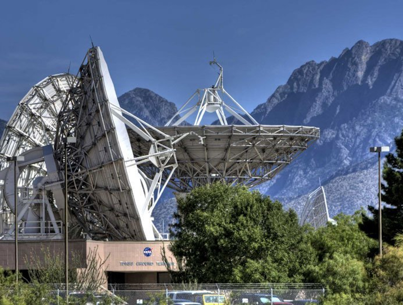
Innovators at the NASA Glenn Research Center have developed the Vortex Radiometer (VR), an early-warning system for communication antennas that identifies atmospheric noise before it reaches the antenna and then optimizes mitigation strategies. Communication links are subject to atmospheric effects that reduce the signal power received at the antenna (i.e., a fade). If the atmospheric losses are too high, the signal level could drop below the minimum measurable power of the receiver, causing data loss across the communication link. Previous attempts to forewarn fading using predictive algorithms have yielded sub-optimal results largely because they rely on real-time performance data from the communications link itself, meaning they have very little time to respond. By contrast, NASA's VR constantly senses incoming noise, which allows real-time measurement and characterization of fading and enables maximization of data throughput.
The Technology
The Vortex Radiometer (VR) creates concentric, annular antenna beam patterns that measure sky-noise temperature. Annular antenna patterns are created by imparting orbital angular momentum into the electric field received by the antenna using spiral phase plates placed in front of the antenna aperture, generating multiple radiometer channels. Data points are then collected by plotting the measured noise temperature of each radiometer channel as a function of time. Noise temperature increases as a noise source (e.g., weather-related noise, signal interference, etc.) traverses the antenna beam patterns. An algorithm is then used to correlate noise temperature peaks in adjacent beams and to determine when a fade will occur, how long the fade will last, and how intense the fade will be. With this information, effective and efficient strategies can be implemented using cognitive communication and antenna systems to autonomously select the optimum fade-mitigation technique and parameter (e.g., increasing the transmission power, adjusting the modulation and/or coding scheme, etc.).
NASA's VR system has been prototyped, including the radiometer device and the algorithm for characterizing noise sources based on VR data. Simulations have shown that a VR system can instruct an existing cognitive antenna to switch between Ka- and X-Band communications in order to avert interference from small diameter noise sources.
Any high-performance communication systems operating in RF or optical frequencies may benefit from NASA's VR capabilities.
 can be used to determine fade characteristics prior to a noise source impinging upon the communication link (blue).")
Benefits
- Data-based measurement of incoming fades: The VR uses measured data and a prediction algorithm to estimate when a fade will occur, how long it will last, and how intense it will be
- Accurate cognitive communication and antenna systems: The VR can provide accurate data to autonomous fade-mitigation antennas
- Adaptable platform: The VR system can be implemented into existing communication systems in current form or with minor modification
Applications
- Aerospace and Aviation: ground communications
- Antennas: incorporation of VR into antenna packages
- Financial communications: point-to-point millimeter-wave communication systems for financial services
- Military: high-performance defense communications
- Marine: ship-to-ship and ship-to-shore communications
- Satellites: telemetry, satellite television, and satellite internet
- Unmanned Vehicles: UAV and drone data transmission
Technology Details
communications
LEW-TOPS-147
LEW-19912-1
"Vortex Radiometry: Fundamental Concepts," Schemmel, Peter J., April 1, 2019,
https://ntrs.nasa.gov/search.jsp?R=20190011721
"Vortex Radiometry: Enabling Frequency Agile Communications," Schemmel, Peter J., May 1, 2019,
https://ntrs.nasa.gov/search.jsp?R=20190025481
https://ntrs.nasa.gov/search.jsp?R=20190011721
"Vortex Radiometry: Enabling Frequency Agile Communications," Schemmel, Peter J., May 1, 2019,
https://ntrs.nasa.gov/search.jsp?R=20190025481
|
Tags:
|
Similar Results

Tunable Multi-Tone, Multi-Band, High-Frequency Synthesizer
Glenn's revolutionary new multi-tone, high-frequency synthesizer can enable a major upgrade in the design of high data rate, wide-band satellite communications links, in addition to the study of atmospheric effects. Conventional single-frequency beacon transmitters have a major limitation: they must assume that atmospheric attenuation and group delay effects are constant at all frequencies across the band of interest. Glenn's synthesizer overcomes this limitation by enabling measurements to be made at multiple frequencies across the entire multi-GHz wide frequency, providing much more accurate and actionable readings.
This novel synthesizer consists of a solid-state frequency comb or harmonic generator that uses step-recovery semiconductor diodes to generate a broad range of evenly spaced harmonic frequencies, which are coherent and tunable over a wide frequency range. These harmonics are then filtered by a tunable bandpass filter and amplified to the necessary power level by a tunable millimeter-wave power amplifier. Next, the amplified signals are transmitted as beacon signals from a satellite to a ground receiving station. By measuring the relative signal strength and phase at ground sites the atmospheric induced effects can be determined, enabling scientists to gather essential climate data on hurricanes and climate change. In addition, the synthesizer can serve as a wideband source in place of a satellite transponder, making it easier to downlink high volumes of collected data to the scientific community. Glenn's synthesizer enables a beacon transmitter that, from the economical CubeSat platform, offers simultaneous, fast, and more accurate wideband transmission from space through the Earth's atmosphere than has ever been possible before.

Low Frequency Portable Acoustic Measurement System
Langley has developed various technologies to enable the portable detection system, including:
- 3-inch electret condenser microphone - unprecedented sensitivity of -45 dB/Hz
- compact nonporous windscreen - suitable for replacing spatially demanding soaker hoses in current use
- infrasonic calibrator for field use - piston phone with a test signal of 110 dB at 14Hz.
- laboratory calibration apparatus - to very low frequencies
- vacuum isolation vessel - sufficiently anechoic to permit measurement of background noise in microphones at frequencies down to a few Hz
- mobile source for reference - a Helmholtz resonator that provides pure tone at 19 Hz
The NASA system uses a three-element array in the field to locate sources of infrasound and their direction. This information has been correlated with PIREPs available in real time via the Internet, with 10 examples of good correlation.

High Altitude UAV for Monitoring Meteorological Parameters
Radiosondes are launched twice a day from different locations of the world and meteorological data is collected to plot the STUV diagram and determining CAPE (Cumulative Average Potential Energy) values. Radiosondes are not re-usable and used only at pre-determined locations around the globe. Moreover, a radiosonde can drift up to 125 miles from its release point. About 75,000 radiosondes are used every year.
Given this unmet need, an inventor at NASA has developed an advanced airborne meteorological system which can provide meteorological parameters at any location at any desired time. In additional to routinely used meteorological sensors, an infrasonic sensor is also included to determine wind shear at local and regional levels. The airborne system may also be used in towns and cities to track drones and UAVs in the area. The airborne vehicle (UAV or drone) should be able to track seismic waves, magnetic storms, magneto-hydrodynamic waves, tornadoes, meteor, and lightning, etc. This technology can be use to measure environmental turbulence including wind shear, vortices as well as large and small eddies is an important factor in forecasting local and regional weather. It can also detect infrasound at ranges of many miles from the source and the shape of the acoustic power spectrum can be used to identify type of turbulence in the atmosphere.

Dynamic Range Enhancement of High-Speed Data Acquisition Systems
Electronic waveforms exist that exceed the capabilities of state-of-the-art data acquisition hardware that is commonly available. The electronic waveforms that need to be measured simultaneously contain wide bandwidth, high frequency content, a DC reference, high dynamic range, and a high crest factor. The NASA Glenn high-speed data acquisition system creates a voltage compression effect with a custom transfer function that is adapted to the voltage range, frequency bandwidth, and electrical impedance of both the test article and data acquisition device. The compression transfer function is later reversed (or decompressed) with a software algorithm to restore the original signal's voltage from the acquired data. The data is thus improved via better signal-to-noise ratio, better low-amplitude accuracy, better resolution, and preservation of high-frequency spectral content. The circuit can be realized with either passive components or both active and passive components. Either realization is specialized for the test article and data acquisition hardware.
This is an early-stage technology requiring additional development. Glenn welcomes co-development opportunities.

Infrasound Sensor Technology
Large aircraft can generate air vortices in their wake, turbulence that can prove hazardous to aircraft that follow too closely. Because wake vortices are invisible, all takeoffs at busy airports are spaced several minutes apart. This separation gives the vortices time to dissipate, even though they only occur 10% of the time, with resulting loss of operational efficiency. Similarly, clear air turbulence is invisible and can also be hazardous to aircraft. By detecting such disturbances through their infrasound emissions, precautions can be taken to avoid them.
Other phenomena can be detected through infrasound, including tornadoes, helicopters on the other side of mountains, underground nuclear explosions and digging tunnels. Through the unique properties of infrasound, many of these can be detected from hundreds of miles away. NASA's infrasound sensor is a highly refined microphone that is capable of detecting acoustic waves from 20 Hz down to dc, the infrasound range. The design is robust and compact, eliminating the bulk and weight found in other technologies. Where most alternative methods are restricted to certain weather conditions and locations,
the NASA sensor filters noise from wind and other sources, allowing its use under any weather or geographic conditions.

