3D Lidar for Autonomous Landing Site Selection
Aerospace
3D Lidar for Autonomous Landing Site Selection (GSC-TOPS-353)
Ocellus 3D lidar, a compact altimetry and hazard avoidance system
Overview
Next generation autonomous planetary exploration missions require advanced sensing capabilities for choosing proper landing areas for the vehicles. Current tools do not have the capability to allow vehicles outside the range of terrestrial control to autonomously perform safe landing operations.
The Ocellus 3D lidar developed by the NASA Goddard Space Flight Center is a lightweight, small-footprint 3D lidar system for planetary and lunar exploration. The new 3D lidar can perform both altimetry (or range-finding) measurements from high altitudes and, at lower altitudes, terrain mapping and imaging. These measurements provide the necessary data for autonomous systems to select safe landing areas for planetary exploration vehicles.
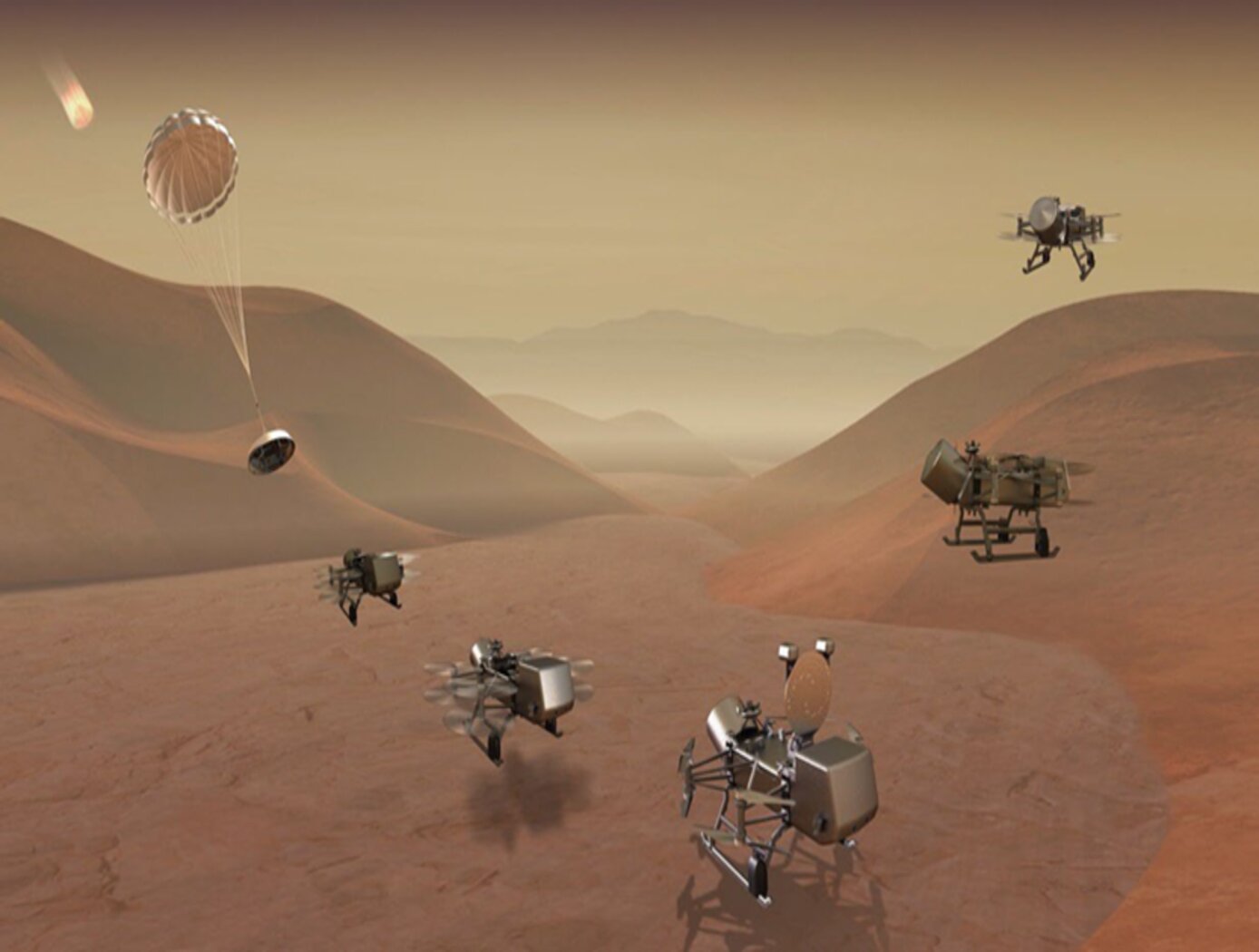
Developed to aid in the safe landing and navigation of the rotocopter for the Dragonfly mission to explore Titan, the Ocellus 3D lidar may be used for a wide variety of altimetry and terrain mapping purposes both in space and terrestrially.
The Technology
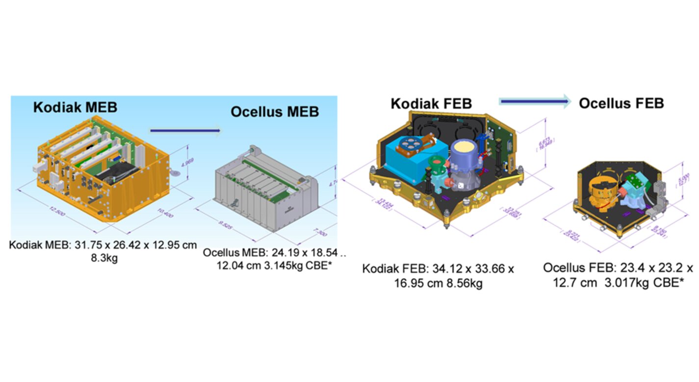
Aerial planetary exploration spacecraft require lightweight, compact, and low power sensing systems to enable successful landing operations. The Ocellus 3D lidar meets those criteria as well as being able to withstand harsh planetary environments. Further, the new tool is based on space-qualified components and lidar technology previously developed at NASA Goddard (i.e., the Kodiak 3D lidar) as shown in the figure below.
The Ocellus 3D lidar quickly scans a near infrared laser across a planetary surface, receives that signal, and translates it into a 3D point cloud. Using a laser source, fast scanning MEMS (micro-electromechanical system)-based mirrors, and NASA-developed processing electronics, the 3D point clouds are created and converted into elevations and images onboard the craft. At ~2 km altitudes, Ocellus acts as an altimeter and at altitudes below 200 m the tool produces images and terrain maps. The produced high resolution (centimeter-scale) elevations are used by the spacecraft to assess safe landing sites.
The Ocellus 3D lidar is applicable to planetary and lunar exploration by unmanned or crewed aerial vehicles and may be adapted for assisting in-space servicing, assembly, and manufacturing operations. Beyond exploratory space missions, the new compact 3D lidar may be used for aerial navigation in the defense or commercial space sectors. The Ocellus 3D lidar is available for patent licensing.


Benefits
- Dual mode operation: high altitude (~2 km) altimetry and lower altitude (20 to 200 m) imaging and hazard detection.
- Space qualified components: the MEMS-based mirror assembly is space qualified.
- Meets low SWaP requirements: the 3D lidar system will be 6 kg and require 70W of power.
- Robust against temperature variation: the tool can survive the significant temperature variations that will be encountered during planetary exploration missions.
- High radiation tolerance: Ocellus is resistant to radiation damage.
Applications
- Aerospace: enhanced navigation and imaging for planetary and lunar exploration as well as for in-space servicing, assembly, and manufacturing.
- Defense: improved autonomous aerial vehicular sensing and navigation.
- Terrain mapping: the 3D lidar may be used in space and terrestrially for mapping terrain features at altitudes below 2 km.
Technology Details
Aerospace
GSC-TOPS-353
GSC-19042-1
|
Tags:
|
|
|
Related Links:
|
Similar Results

3D Lidar for Improved Rover Traversal and Imagery
The SQRLi system is made up of three major components including the laser assembly, the mirror assembly, and the electronics and data processing equipment (electronics assembly) as shown in the figure below. The three main systems work together to send and receive the lidar signal then translate it into a 3D image for navigation and imaging purposes.
The rover sensing instrument makes use of a unique fiber optic laser assembly with high, adjustable output that increases the dynamic range (i.e., contrast) of the lidar system. The commercially available mirror setup used in the SQRLi is small, reliable, and has a wide aperture that improves the field-of-view of the lidar while maintaining a small instrument footprint. Lastly, the data processing is done by an in-house designed processor capable of translating the light signal into a high-resolution (sub-millimeter) 3D map. These components of the SQRLi enable successful hazard detection and navigation in visibility-impaired environments.
The SQRLi is applicable to planetary and lunar exploration by unmanned or crewed vehicles and may be adapted for in-space servicing, assembly, and manufacturing purposes. Beyond NASA missions, the new 3D lidar may be used for vehicular navigation in the automotive, defense, or commercial space sectors. The SQRLi is available for patent licensing.

Photon-Efficient Scanning LiDAR System
This new methodology selectively scans an area of interest and effectively pre-compresses the image data. Instead of using LiDAR resources to gather redundant data, only the necessary data is gathered and the redundancy can be used to fill in up-sampled data using intelligent completion algorithms. The system utilizes a unique LiDAR system to collect a pattern of specific points across a given area by modulating the incoming light, creating a pattern that can be decoded computationally to reconstruct a scene. By designing specific coding patterns, the system can strategically skip certain measurements during the scanning process to create an under-sampled image area.
The system reconstructs the under-sampled area to recreate an accurate representation of the original object or area being scanned. As a result, redundant data is prevented from being collected by reducing the number of required measurements and data condensed in post-collection to reduce power consumption. By selectively skipping certain pixels during the scan and using sophisticated recovery algorithms to reconstruct the omitted information, the system makes more efficient use of the available photons, thereby enhancing overall data collection.
This technology represents a significant advancement in LiDAR systems, offering a more useful method for data collection and processing and addresses the challenges of power consumption and data redundancy, allowing for more sustainable and effective remote sensing applications. This technology can offer advantages in applications such as mapping for construction, surveying, forestry, or farming as well as computer vision for vehicles or robotics.

LiDAR with Reduced-Length Linear Detector Array
The LiDAR with Reduced-Length Linear Detector Array improves upon a prior fast-wavelength-steering, time-division-multiplexing 3D imaging system with two key advancements: laser linewidth broadening to reduce speckle noise and improve the signal-to-noise ratio, and the integration of a slow-scanning mirror with wavelength-steering technology to enable 2D swath mapping capabilities. Range and velocity are measured using the time-of-flight of short laser pulses. This highly efficient LiDAR incorporates emerging technologies, including a photonic integrated circuit seed laser, a high peak-power fiber amplifier, and a linear-mode photon-sensitive detector array.
With no moving parts, the transmitter rapidly steers a single high-power laser beam across up to 2,000 resolvable footprints. Fast beam steering is achieved through an innovative high-speed wavelength-tuning technology and a single grating design that enables wavelength-to-angle dispersion while rejecting solar background for all transmitted wavelengths. To optimize receiver power and reduce data volume, sequential returns from up to 10 different tracks are time-division-multiplexed and digitized by a high-speed digitizer for surface ranging. Each track’s atmospheric return can be digitized in parallel at a lower resolution using an ultra-low-power digitizer.
Originally developed by NASA for SmallSat missions, this system’s precise and accurate observation capabilities—combined with reduced costs, size, weight, and power constraints—make it applicable to a wide range of LiDAR applications. The LiDAR with Reduced-Length Linear Detector Array is currently at Technology Readiness Level (TRL) 4 (validated in a laboratory environment) and is available for patent licensing.

Super Resolution 3D Flash LIDAR
This suite of technologies includes a method, algorithms, and computer processing techniques to provide for image photometric correction and resolution enhancement at video rates (30 frames per second). This 3D (2D spatial and range) resolution enhancement uses the spatial and range information contained in each image frame, in conjunction with a sequence of overlapping or persistent images, to simultaneously enhance the spatial resolution and range and photometric accuracies. In other words, the technologies allows for generating an elevation (3D) map of a targeted area (e.g., terrain) with much enhanced resolution by blending consecutive camera image frames. The degree of image resolution enhancement increases with the number of acquired frames.

eVTOL UAS with Lunar Lander Trajectory
This NASA-developed eVTOL UAS is a purpose-built, electric, reusable aircraft with rotor/propeller thrust only, designed to fly trajectories with high similarity to those flown by lunar landers. The vehicle has the unique capability to transition into wing borne flight to simulate the cross-range, horizontal approaches of lunar landers. During transition to wing borne flight, the initial transition favors a traditional airplane configuration with the propellers in the front and smaller surfaces in the rear, allowing the vehicle to reach high speeds. However, after achieving wing borne flight, the vehicle can transition to wing borne flight in the opposite (canard) direction. During this mode of operation, the vehicle is controllable, and the propellers can be powered or unpowered.
This NASA invention also has the capability to decelerate rapidly during the descent phase (also to simulate lunar lander trajectories). Such rapid deceleration will be required to reduce vehicle velocity in order to turn propellers back on without stalling the blades or catching the propeller vortex. The UAS also has the option of using variable pitch blades which can contribute to the overall controllability of the aircraft and reduce the likelihood of stalling the blades during the deceleration phase.
In addition to testing EDL sensors and precision landing payloads, NASA’s innovative eVTOL UAS could be used in applications where fast, precise, and stealthy delivery of payloads to specific ground locations is required, including military applications. This concept of operations could entail deploying the UAS from a larger aircraft.


