Closed Ecological System Network Data Collection, Analysis, Control, and Optimization System
Environment
Closed Ecological System Network Data Collection, Analysis, Control, and Optimization System (TOP2-296)
A Rapid, Low-Cost Approach to Permanently Extend Life Beyond Earth
Overview
The Earth's biosphere is the most sophisticated complex adaptive system known to exist in the entire universe and has persisted for over 4 billion years. A complex adaptive system is a network of interacting adaptive systems whose nonlinear dynamics and emergent behaviors are difficult to predict and control; therefore, for such systems, past performance is no guarantee of future results, which is particularly the case for the Earth’s biosphere during a period of exponential technological growth. NASA Ames Research Center presents a novel, patent-pending adjustable-autonomous intelligent systems approach for developing sustainable, small-scale reproductions of subsets of the Earth’s biosphere that can be distributed both on and beyond Earth, for improving the quality of life for all life, expanding the diversity of life, studying and protecting life, as well as enabling life to permanently extend beyond Earth.
The Technology
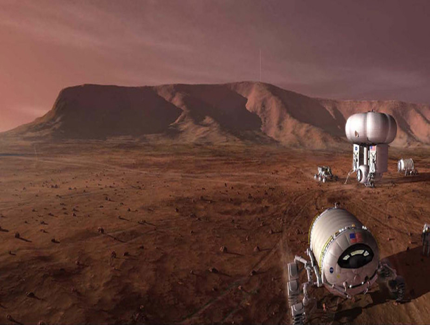
The technology relates generally to controlled ecosystems, and more particularly, to a Controlled Closed-Ecosystem Development System (CCEDS) that can be used to develop designs for sustainable, small-scale reproductions of subsets of the Earth’s biosphere and the Orbiting Modular Artificial-Gravity Spacecraft (OMAGS). The technology encompassing a CCEDS includes one or more a Closed Ecological Systems (CESs), each having one or more Controlled Ecosystem Modules (CESMs). Each CESM can have a biome containing at least one organism, and equipment comprising one or more of sensors, actuators, or components that are associated with the biome. A controller operates the equipment to effect transfer of material among CESMs to optimize one or more CESM biomes with respect to their organism population health, resilience, variety, quantities, biomass, and sustainability. A CES is a community of organisms and their resources that persist in a sealed volume such that mass is not added or removed. The mass (food/air/water) required by the CES organisms is continually recycled from the mass (waste) produced by the organisms. Energy and information may be transferred to and from a CES. CES research promises to become a significant resource for the resolution of global ecology problems which have thus far been experimentally inaccessible and may very well prove an invaluable resource for predicting the probable ecological consequences of anthropogenic materials on regional ecosystems. In order to create CESs that are orders of magnitude smaller than the Earth that can function without the Earth, the desired gravity level and necessary radiation shielding must be provided by other means. Orbiting Modular Artificial-Gravity Spacecraft (OMAGS) is a fractional gravity spacecraft design for CES payloads and is depicted in Figures below. In tandem, the CCEDS and OMAGS systems can be used to foster gravitational ecosystem research for developing sustainable communities in space and on Earth.

Benefits
- Closed EcoSystems (CESs) can be used as spacecraft payloads or Earth test-beds to study the long-term effects of various sealed, dynamic environments, including changing gravity and radiation levels, on interacting populations of organisms
- Sustainability: Offers “reduce, reuse, and recycle” benefits
- Autonomous operation: Does not require flight crew attention; can function for long duration on manned and unmanned spacecraft
- Holds the prospect of permanently establishing life beyond Earth; initially with microbes, plants, and small animals, but ultimately in CESs with humans
- Reduction in cost and complexity: Brings monitoring and actuation to closed ecosystems to help automate and increase the sustainability of the environment
- Real-time monitoring: Uses cloud-based technology to monitor sensor arrays across multiple ecosystems in real time, allowing for long-term monitoring of sustainability experiments
- Algorithms and data: Adaptive algorithms and data derived from experiments will provide unforeseen insights
Applications
- Study of life under variable radiation and gravity conditions, both in space and on Earth
- Study of evolutionary adaptative trajectories taken by living organisms in persistent low-gravity and high radiation environments
- Long-term life sustainability in space environments and evolution in space environments
- Aquariums and bottle gardens industry
- Commercial space industry
- Self-contained ecosystems
- Vertical agriculture
- Fermentation in pharmaceutical manufacturing
- “Artificial gut microbiome” to facilitate drug testing, antibiotic production
- Small pet industry (no feeding, cleaning, or smell)
Technology Details
Environment
TOP2-296
ARC-18289-1
Patent Pending
https://ntrs.nasa.gov/citations/20190000114
https://ntrs.nasa.gov/citations/20180007936
https://ntrs.nasa.gov/citations/20180007936
Similar Results

Algorithms for stabilizing intelligent networks
Some of the current challenges faced by research in artificial intelligence and autonomous control systems include providing self control, resilience, adaptability, and stability for intelligent systems, especially over a long period of time, in changing environments. The Evolvable Neural Software System (ENSS), Formulation for Emotion Embedding in Logic Systems (FEELS), Stability Algorithm for Neural Entities (SANE), and the Logic Expansion for Autonomously Reconfigurable Neural Systems (LEARNS) are foundations for tackling some of these challenges, by providing the basic algorithms evolvable systems could use to manage its own behavior.
These algorithms would allow networks to self regulate, noticing unusual behavior and the circumstances that may have caused that behavior, and then correcting to behave more predictably when similar circumstances are encountered. The process is similar to how psychology in organisms evolved iteratively, eventually finding and keeping better responses to given stimuli.

Otoacoustic Protection In Biologically-Inspired Systems
This innovation is an autonomic method capable of transmitting a neutralizing data signal to counteract a potentially harmful signal. This otoacoustic component of an autonomic unit can render a potentially harmful incoming signal inert. For selfmanaging systems, the technology can offer a selfdefense capability that brings new levels of automation and dependability to systems.

Intelligent Conversational Research Assistant
Previous virtual digital assistants (e.g., Siri®, Google Assistant®, Cortana®, Alexa®, etc.) allow users to speak requests to computers or mobile phones, which then perform speech-to-text recognition and execute web searches based on the content of the user's request. However, such systems cannot provide answers that are geospatially and space-time aware, for example, what the weather was like in San Francisco three days ago. In addition, typical virtual assistants only allow community users to indirectly influence system behavior through their queries.
MATA provides a conversational assistant and associated computing to turn 40 years and hundreds of terabytes of Earth science of NASA Earth science data into usable knowledge. This system engages with users in an integrated, conversational manner using natural language dialogue, and invokes external web services, when appropriate, to obtain information and perform various actions on a variety of satellite and geospatial data to provide spatio-temporally aware answers. MATA is conversational computing, not just a conversational assistant.
Broadly, this technology takes a query, translates that query into to an intent, then that intent invokes the right capability, which in turn invokes the right APIs for computations that take milliseconds. MATA does not simply retrieve an answer from a database, but it intelligently answers a user's question within its specific context.

Low Weight Flight Controller Design
Increasing demand for smaller UAVs (e.g., sometimes with wingspans on the order of six inches and weighing less than one pound) generated a need for much smaller flight and sensing equipment. NASA Langley's new sensing and flight control system for small UAVs includes both an active flight control board and an avionics sensor board. Together, these compare the status of the UAVs position, heading, and orientation with the pre-programmed data to determine and apply the flight control inputs needed to maintain the desired course.
To satisfy the small form-factor system requirements, micro-electro-mechanical systems (MEMS) are used to realize the various flight control sensing devices. MEMS-based devices are commercially available single-chip devices that lend themselves to easy integration onto a circuit board. The system uses less energy than current systems, allowing solar panels planted on the vehicle to generate the systems power. While the lightweight technology was designed for smaller UAVs, the sensors could be distributed throughout larger UAVs, depending on the application.

Real-Time, High-Resolution Terrain Information in Computing-Constrained Environments
NASA Armstrong collaborated with the U.S. Air Force to develop algorithms that interpret highly encoded large area terrain maps with geographically user-defined error tolerances. A key feature of the software is its ability to locally decode and render DTMs in real time for a high-performance airplane that may need automatic course correction due to unexpected and dynamic events. Armstrong researchers are integrating the algorithms into a Global Elevation Data Adaptive Compression System (GEDACS) software package, which will enable customized maps from a variety of data sources.
How It Works
The DTM software achieves its high performance encoding and decoding processes using a unique combination of regular and semi-regular geometric tiling for optimal rendering of a requested map. This tiling allows the software to retain important slope information and continuously and accurately represent the terrain. Maps and decoding logic are integrated into an aircraft's existing onboard computing environment and can operate on a mobile device, an EFB, or flight control and avionics computer systems. Users can adjust the DTM encoding routines and error tolerances to suit evolving platform and mission requirements. Maps can be tailored to flight profiles of a wide range of aircraft, including fighter jets, UAVs, and general aviation aircraft.
The DTM and GEDACS software enable the encoding of global digital terrain data into a file size small enough to fit onto a tablet or other handheld/mobile device for next-generation ground collision avoidance. With improved digital terrain data, aircraft could attain better performance. The system monitors the ground approach and an aircraft's ability to maneuver by predicting several multidirectional escape trajectories, a feature that will be particularly advantageous to general aviation aircraft.
Why It Is Better
Conventional DTM encoding techniques used aboard high-performance aircraft typically achieve relatively low encoding process ratios. Also, the computational complexity of the decoding process can be high, making them unsuitable for the real-time constrained computing environments of high-performance aircraft. Implementation costs are also often prohibitive for general aviation aircraft. This software achieves its high encoding process ratio by intelligently interpreting its maps rather than requiring absolute retention of all data. For example, the DTM software notes the perimeter and depth of a mining pit but ignores contours that are irrelevant based on the climb and turn performance of a particular aircraft and therefore does not waste valuable computational resources. Through this type of intelligent processing, the software eliminates the need to maintain absolute retention of all data and achieves a much higher encoding process ratio than conventional terrain-mapping software. The resulting exceptional encoding process allows users to store a larger library of DTMs in one place, enabling comprehensive map coverage at all times. Additionally, the ability to selectively tailor resolution enables high-fidelity sections of terrain data to be incorporated seamlessly into a map.